
Geographic Region: USA-INDIANA
Feature: MT. CARMEL, WABASH RIVER
|
Geographic Region: USA-INDIANA Feature: MT. CARMEL, WABASH RIVER |
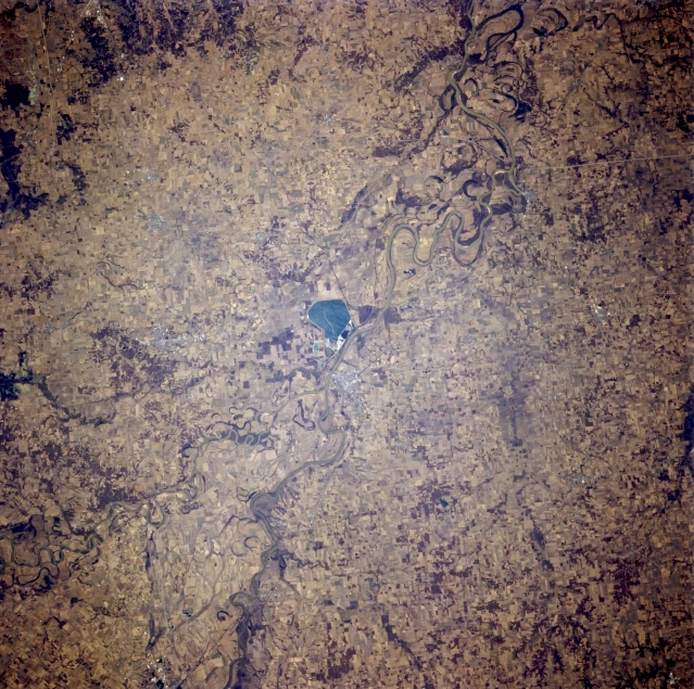 |
| STS062-081-005 White River and Wabash River, Indiana, U.S.A. March 1994 Discernible in this near-vertical photograph are the White River and the Wabash River (left bottom center), which separates Illinois and Indiana. One of the Wabash's major tributaries, the White River, joins the Wabash north of a large pond visible near the center of the photograph. The fertile land on either side of the Wabash River is good for growing corn and soybeans and for raising livestock. |
| Images: | All Available Images Low-Resolution 405k |
|
| Mission: | STS062 |
|
| Roll - Frame: | 81 - 5 |
|
| Geographical Name: | USA-INDIANA |
|
| Features: | MT. CARMEL, WABASH RIVER |
|
| Center Lat x Lon: | 38.5N x 88W |
|
| Film Exposure: | N | N=Normal exposure, U=Under exposed, O=Over exposed, F=out of Focus |
| Percentage of Cloud Cover-CLDP: | 0 |
|
| Camera:: | HB |
|
| Camera Tilt: | 12 | LO=Low Oblique, HO=High Oblique, NV=Near Vertical |
| Camera Focal Length: | 250 |
|
| Nadir to Photo Center Direction: | SW | The direction from the nadir to the center point, N=North, S=South, E=East, W=West |
| Stereo?: | N | Y=Yes there is an adjacent picture of the same area, N=No there isn't |
| Orbit Number: | 3 |
|
| Date: | 19940304 | YYYYMMDD |
| Time: | 170723 | GMT HHMMSS |
| Nadir Lat: | 39.0N |
Latitude of suborbital point of spacecraft |
| Nadir Lon: | 87.7W |
Longitude of suborbital point of spacecraft |
| Sun Azimuth: | 161 | Clockwise angle in degrees from north to the sun measured at the nadir point |
| Space Craft Altitude: | 161 | nautical miles |
| Sun Elevation: | 43 | Angle in degrees between the horizon and the sun, measured at the nadir point |
| Land Views: | VALLEY |
|
| Water Views: | RIVER |
|
| Atmosphere Views: | |
|
| Man Made Views: | AGRICULTURE |
|
| City Views: | |
|
Photo is not associated with any sequences | ||
| NASA Home Page |
JSC Home Page |
JSC Digital Image Collection |
Earth Science & Remote Sensing |
|
This service is provided by the International Space Station program and the JSC Earth Science & Remote Sensing Unit, ARES Division, Exploration Integration Science Directorate.

|