
Geographic Region: USA-TEXAS
Feature: FORT STOCKTON,PIVOT IRR.
|
Geographic Region: USA-TEXAS Feature: FORT STOCKTON,PIVOT IRR. |
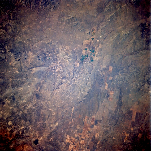 |
| STS062-104-008 Fort Stockton, Texas, U.S.A. March 1994 The intersection of east-west-oriented Interstate Highway 10 and a northeast-southwest railroad right-of-way helps to locate Fort Stockton in this oblique, southwest-looking photograph. This west Texas city is located on flat, open Stockton Plateau. Apparent are irrigated, cultivated fields (more numerous toward the north) and small, dark Imperial Reservoir immediately south of the Pecos River. |
| Images: | All Available Images Low-Resolution 383k |
|
| Mission: | STS062 |
|
| Roll - Frame: | 104 - 8 |
|
| Geographical Name: | USA-TEXAS |
|
| Features: | FORT STOCKTON,PIVOT IRR. |
|
| Center Lat x Lon: | 31.0N x 103W |
|
| Film Exposure: | N | N=Normal exposure, U=Under exposed, O=Over exposed, F=out of Focus |
| Percentage of Cloud Cover-CLDP: | 0 |
|
| Camera:: | HB |
|
| Camera Tilt: | 23 | LO=Low Oblique, HO=High Oblique, NV=Near Vertical |
| Camera Focal Length: | 250 |
|
| Nadir to Photo Center Direction: | SW | The direction from the nadir to the center point, N=North, S=South, E=East, W=West |
| Stereo?: | N | Y=Yes there is an adjacent picture of the same area, N=No there isn't |
| Orbit Number: | 49 |
|
| Date: | 19940307 | YYYYMMDD |
| Time: | 141857 | GMT HHMMSS |
| Nadir Lat: | 31.5N |
Latitude of suborbital point of spacecraft |
| Nadir Lon: | 102W |
Longitude of suborbital point of spacecraft |
| Sun Azimuth: | 105 | Clockwise angle in degrees from north to the sun measured at the nadir point |
| Space Craft Altitude: | 160 | nautical miles |
| Sun Elevation: | 14 | Angle in degrees between the horizon and the sun, measured at the nadir point |
| Land Views: | RANGE, HILL, PLATEAU |
|
| Water Views: | |
|
| Atmosphere Views: | |
|
| Man Made Views: | HIGHWAY, AGRICULTURE |
|
| City Views: | |
|
Photo is not associated with any sequences | ||
| NASA Home Page |
JSC Home Page |
JSC Digital Image Collection |
Earth Science & Remote Sensing |
|
This service is provided by the International Space Station program and the JSC Earth Science & Remote Sensing Unit, ARES Division, Exploration Integration Science Directorate.

|