
Geographic Region: USA-TEXAS
Feature: AMISTAD RESERVOIR,MEXICO
|
Geographic Region: USA-TEXAS Feature: AMISTAD RESERVOIR,MEXICO |
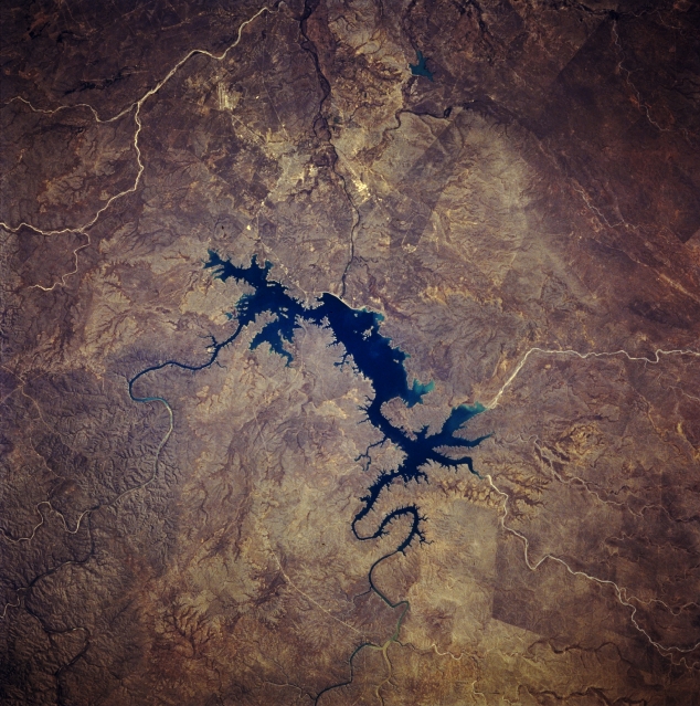 |
| STS060-083-034 International Amistad Reservoir, Texas, U.S.A. February 1994 The arid, sparsely vegetated terrain of this region contrasts sharply with deep blue International Amistad Reservoir that is located on the United States-Mexico border. The Rio Grande feeds into Amistad from the northwest and continues its southeasterly course. Devils River and its deeply incised canyon, cut through limestone and sandstone rocks, enters the reservoir from the northeast. Three light, intermittently flowing river courses and their canyons are discernible--two are on the Mexican side of the border at the western end of the reservoir, and the third flows into the Rio Grande southeast of Del Rio, east of which appear the runway and apron of Laughlin Air Force Base (middle left edge). |
| Images: | All Available Images Low-Resolution 371k |
|
| Mission: | STS060 |
|
| Roll - Frame: | 83 - 34 |
|
| Geographical Name: | USA-TEXAS |
|
| Features: | AMISTAD RESERVOIR,MEXICO |
|
| Center Lat x Lon: | 29.5N x 101W |
|
| Film Exposure: | N | N=Normal exposure, U=Under exposed, O=Over exposed, F=out of Focus |
| Percentage of Cloud Cover-CLDP: | 0 |
|
| Camera:: | HB |
|
| Camera Tilt: | 18 | LO=Low Oblique, HO=High Oblique, NV=Near Vertical |
| Camera Focal Length: | 250 |
|
| Nadir to Photo Center Direction: | E | The direction from the nadir to the center point, N=North, S=South, E=East, W=West |
| Stereo?: | Y | Y=Yes there is an adjacent picture of the same area, N=No there isn't |
| Orbit Number: | 116 |
|
| Date: | 19940210 | YYYYMMDD |
| Time: | 201137 | GMT HHMMSS |
| Nadir Lat: | 29.7N |
Latitude of suborbital point of spacecraft |
| Nadir Lon: | 102W |
Longitude of suborbital point of spacecraft |
| Sun Azimuth: | 203 | Clockwise angle in degrees from north to the sun measured at the nadir point |
| Space Craft Altitude: | 192 | nautical miles |
| Sun Elevation: | 43 | Angle in degrees between the horizon and the sun, measured at the nadir point |
| Land Views: | DESERT, HILL |
|
| Water Views: | RIVER, RESERVOIR |
|
| Atmosphere Views: | |
|
| Man Made Views: | DAM |
|
| City Views: | |
|
Photo is not associated with any sequences | ||
| NASA Home Page |
JSC Home Page |
JSC Digital Image Collection |
Earth Science & Remote Sensing |
|
This service is provided by the International Space Station program and the JSC Earth Science & Remote Sensing Unit, ARES Division, Exploration Integration Science Directorate.

|