
Geographic Region: USA-CALIFORNIA
Feature: TULE LAKE, LAVA FIELDS
|
Geographic Region: USA-CALIFORNIA Feature: TULE LAKE, LAVA FIELDS |
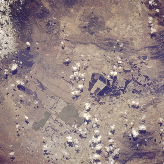 |
| STS059-089-084 Tule Lake and Lava Beds, California, U.S.A. April 1994 Tule Lake, a national wildlife refuge just south of the California-Oregon border, is visible to the left center in this near-vertical photograph. During World War II, Tule Lake was the site of a Japanese relocation camp. South of Tule Lake is snow-covered Lava Beds National Monument. It was in these lava beds that the Modoc Indians made their final stand against the United States Cavalry in 1873. Discernible west of Tule Lake are agricultural field patterns of drained, lower Klamath Lake. |
| Images: | All Available Images Low-Resolution 348k |
|
| Mission: | STS059 |
|
| Roll - Frame: | 89 - 84 |
|
| Geographical Name: | USA-CALIFORNIA |
|
| Features: | TULE LAKE, LAVA FIELDS |
|
| Center Lat x Lon: | 42.0N x 121.5W |
|
| Film Exposure: | N | N=Normal exposure, U=Under exposed, O=Over exposed, F=out of Focus |
| Percentage of Cloud Cover-CLDP: | 10 |
|
| Camera:: | HB |
|
| Camera Tilt: | 16 | LO=Low Oblique, HO=High Oblique, NV=Near Vertical |
| Camera Focal Length: | 250 |
|
| Nadir to Photo Center Direction: | NW | The direction from the nadir to the center point, N=North, S=South, E=East, W=West |
| Stereo?: | N | Y=Yes there is an adjacent picture of the same area, N=No there isn't |
| Orbit Number: | 24 |
|
| Date: | 19940410 | YYYYMMDD |
| Time: | 213645 | GMT HHMMSS |
| Nadir Lat: | 41.6N |
Latitude of suborbital point of spacecraft |
| Nadir Lon: | 121.1W |
Longitude of suborbital point of spacecraft |
| Sun Azimuth: | 218 | Clockwise angle in degrees from north to the sun measured at the nadir point |
| Space Craft Altitude: | 119 | nautical miles |
| Sun Elevation: | 51 | Angle in degrees between the horizon and the sun, measured at the nadir point |
| Land Views: | HILL |
|
| Water Views: | |
|
| Atmosphere Views: | |
|
| Man Made Views: | AGRICULTURE |
|
| City Views: | |
|
Photo is not associated with any sequences | ||
| NASA Home Page |
JSC Home Page |
JSC Digital Image Collection |
Earth Science & Remote Sensing |
|
This service is provided by the International Space Station program and the JSC Earth Science & Remote Sensing Unit, ARES Division, Exploration Integration Science Directorate.

|