
Geographic Region: USA-SOUTH DAKOTA
Feature: MISSOURI RIVER
|
Geographic Region: USA-SOUTH DAKOTA Feature: MISSOURI RIVER |
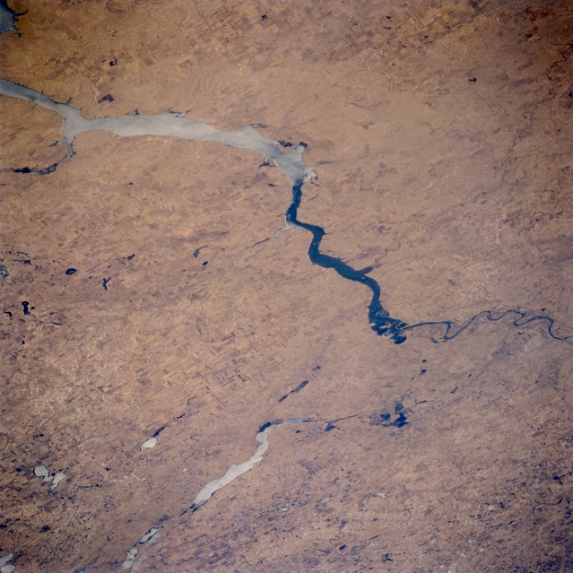 |
| STS059-089-036 Lake Oahe, Long Lake, and Bismarck, North Dakota, U.S.A. April 1994 Visible in this southwest-looking, low-oblique photograph is the northern end of Lake Oahe [250 miles (403 kilometers) long], which ends approximately 6 miles (10 kilometers) from Bismarck, the capital of North Dakota (barely discernible at right center). Bismarck, located on rolling hills overlooking the Missouri River, is a trade and distributing point for spring wheat, livestock, and dairy products. Food items, farm machinery, and wood and concrete products are also manufactured. Bismarck is the center for development of the rich oil reserves of the Williston Basin. Hook-shaped, ice-covered Long Lake and Long Lake National Wildlife Refuge are visible (bottom center). Much of Lake Oahe is also ice covered. |
| Images: | All Available Images Low-Resolution 350k |
|
| Mission: | STS059 |
|
| Roll - Frame: | 89 - 36 |
|
| Geographical Name: | USA-SOUTH DAKOTA |
|
| Features: | MISSOURI RIVER |
|
| Center Lat x Lon: | 43.5N x 99.5W |
|
| Film Exposure: | N | N=Normal exposure, U=Under exposed, O=Over exposed, F=out of Focus |
| Percentage of Cloud Cover-CLDP: | 0 |
|
| Camera:: | HB |
|
| Camera Tilt: | 42 | LO=Low Oblique, HO=High Oblique, NV=Near Vertical |
| Camera Focal Length: | 250 |
|
| Nadir to Photo Center Direction: | E | The direction from the nadir to the center point, N=North, S=South, E=East, W=West |
| Stereo?: | Y | Y=Yes there is an adjacent picture of the same area, N=No there isn't |
| Orbit Number: | 23 |
|
| Date: | 19940410 | YYYYMMDD |
| Time: | 200710 | GMT HHMMSS |
| Nadir Lat: | 43.6N |
Latitude of suborbital point of spacecraft |
| Nadir Lon: | 101.3W |
Longitude of suborbital point of spacecraft |
| Sun Azimuth: | 213 | Clockwise angle in degrees from north to the sun measured at the nadir point |
| Space Craft Altitude: | 119 | nautical miles |
| Sun Elevation: | 51 | Angle in degrees between the horizon and the sun, measured at the nadir point |
| Land Views: | PLAIN |
|
| Water Views: | LAKE |
|
| Atmosphere Views: | |
|
| Man Made Views: | |
|
| City Views: | |
|
Photo is not associated with any sequences | ||
| NASA Home Page |
JSC Home Page |
JSC Digital Image Collection |
Earth Science & Remote Sensing |
|
This service is provided by the International Space Station program and the JSC Earth Science & Remote Sensing Unit, ARES Division, Exploration Integration Science Directorate.

|