
Geographic Region: USA-PENNSYLVANIA
Feature: ALLEGHENY MOUNTAINS
|
Geographic Region: USA-PENNSYLVANIA Feature: ALLEGHENY MOUNTAINS |
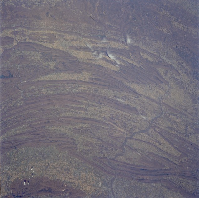 |
| STS059-205-067 Appalachian Mountains, South Central Pennsylvania, U.S.A. April 1994 The obvious features in this photograph are the folded ranges of the Appalachian Mountains in south-central Pennsylvania. This ridge and valley structure is part of the northeast-southwest trend of eroded remnants of a great mountain mass that was formed by folding (compression forces) and consists primarily of sedimentary rocks. Several water gaps are visible where the Susquehanna River continues to cut through the ridges, especially north of Harrisburg, the state capital (southeastern edge of the photograph). The smaller Juniata River, a major tributary of the Susquehanna River, can be seen in some of the valleys. The Appalachian Mountains in this region generally do not exceed 2000 feet (600 meters) above sea level. Mountain vegetation is a mixture of deciduous and evergreen forests. The Cumberland Valley (southern edge of the photograph), with an average width of 12 miles (19 kilometers), is part of a valley that extends southwestward to the Shenandoah Valley of Virginia. Most of the valleys in this region have very fertile soils; therefore, agricultural activities are abundant. Many croplands are devoted to corn, oats, wheat, and hay, which are used as feed for cattle. (Refer to STS-059-217-073 photograph for a detailed view of the Harrisburg metropolitan area.) |
| Images: | All Available Images Low-Resolution 113k |
|
| Mission: | STS059 |
|
| Roll - Frame: | 205 - 67 |
|
| Geographical Name: | USA-PENNSYLVANIA |
|
| Features: | ALLEGHENY MOUNTAINS |
|
| Center Lat x Lon: | 40.5N x 77.5W |
|
| Film Exposure: | N | N=Normal exposure, U=Under exposed, O=Over exposed, F=out of Focus |
| Percentage of Cloud Cover-CLDP: | 0 |
|
| Camera:: | HB |
|
| Camera Tilt: | 26 | LO=Low Oblique, HO=High Oblique, NV=Near Vertical |
| Camera Focal Length: | 100 |
|
| Nadir to Photo Center Direction: | NE | The direction from the nadir to the center point, N=North, S=South, E=East, W=West |
| Stereo?: | Y | Y=Yes there is an adjacent picture of the same area, N=No there isn't |
| Orbit Number: | 102 |
|
| Date: | 19940415 | YYYYMMDD |
| Time: | 170238 | GMT HHMMSS |
| Nadir Lat: | 39.7N |
Latitude of suborbital point of spacecraft |
| Nadir Lon: | 78W |
Longitude of suborbital point of spacecraft |
| Sun Azimuth: | 175 | Clockwise angle in degrees from north to the sun measured at the nadir point |
| Space Craft Altitude: | 114 | nautical miles |
| Sun Elevation: | 60 | Angle in degrees between the horizon and the sun, measured at the nadir point |
| Land Views: | MOUNTAIN, VALLEY |
|
| Water Views: | RIVER |
|
| Atmosphere Views: | |
|
| Man Made Views: | AGRICULTURE |
|
| City Views: | |
|
Photo is not associated with any sequences | ||
| NASA Home Page |
JSC Home Page |
JSC Digital Image Collection |
Earth Science & Remote Sensing |
|
This service is provided by the International Space Station program and the JSC Earth Science & Remote Sensing Unit, ARES Division, Exploration Integration Science Directorate.

|