
Geographic Region: BOLIVIA
Feature: LAKE POOPO AREA
|
Geographic Region: BOLIVIA Feature: LAKE POOPO AREA |
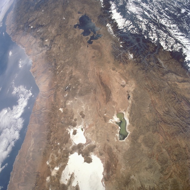 |
| STS057-099-065 Central Andes Mountains, South America June 1993 This small-scale photograph provides an opportunity to see a large geographic region of the central Andes Mountains of South America. The light tans and browns of the west coasts of northern Chile and Peru indicate an arid climate along the western foothills of the Andes Mountains. Clearly visible in this photograph is a large part of the northern Atacama Desert, one of the driest deserts on Earth, with its deeply eroded, short, well-entrenched streams. Even the very deep canyons in the coastal mountains of Peru can be seen. Eastward from this arid, rather narrow, west coastal zone lie the volcanic peaks and rugged mountains of the Cordillera Occidental. Many of the volcanic peaks in this mountainous zone exceed 19 000 feet (5800 meters). Immediately east of the volcanic zone, the elevated, rolling plateau known as the Altiplano is apparent. This plateau, which averages 12 000 feet (3600 meters) above sea level, stretches for approximately 250 miles (400 kilometers) north-south, mostly in Bolivia, between the western and eastern cordilleras (mountain ranges). Lake Titicaca, the world's highest navigable body of water (large lake to the north), is generally acknowledged as the northern limit of the Altiplano. The southern boundary (not shown in this photograph) is less well-defined, but it is generally accepted that the Altiplano ends south of an area with numerous salars (dry lakes). Smaller, greenish Lake Poopó was formed by interior drainage. Water levels fluctuate widely in this shallow, salty lake. The large, whitish features are salars; the smaller dry lake to the north is Salar de Coipasa, and the larger one is Salar de Uyuni. These salars are excellent landmarks for orbiting astronauts. Although difficult to discern at this scale, the capital city of La Paz, Bolivia, (1 million population) is located on the Altiplano southeast of Lake Titicaca. The parallel, mountainous ridges of the Cordillera Oriental border the Altiplano to the east. This is very rugged, mountainous terrain with many deeply incised streams creating severe canyons and valleys. Many of the ridges and peaks throughout this area exceed 16 000 feet (4900 meters) in elevation. The pronounced drainage pattern southeast of Lake Titicaca results from the headwaters of the Rio Beni eroding a dendritic stream pattern in this section of the Altiplano. The Rio Madeira, which receives the waters of the Rio Beni, eventually flows into the Amazon, which empties into the Atlantic Ocean. Because of the elevation drop in the southwestern Amazon Basin, clouds have formed along the mountainous boundary, providing a significant clue to the impact the high Andes Mountains have on the climate of South America. |
| Images: | All Available Images Low-Resolution 136k |
|
| Mission: | STS057 |
|
| Roll - Frame: | 99 - 65 |
|
| Geographical Name: | BOLIVIA |
|
| Features: | LAKE POOPO AREA |
|
| Center Lat x Lon: | 18.5S x 70W |
|
| Film Exposure: | N | N=Normal exposure, U=Under exposed, O=Over exposed, F=out of Focus |
| Percentage of Cloud Cover-CLDP: | 5 |
|
| Camera:: | HB |
|
| Camera Tilt: | 40 | LO=Low Oblique, HO=High Oblique, NV=Near Vertical |
| Camera Focal Length: | 50 |
|
| Nadir to Photo Center Direction: | W | The direction from the nadir to the center point, N=North, S=South, E=East, W=West |
| Stereo?: | N | Y=Yes there is an adjacent picture of the same area, N=No there isn't |
| Orbit Number: | 127 |
|
| Date: | 19930629 | YYYYMMDD |
| Time: | 173815 | GMT HHMMSS |
| Nadir Lat: | 19S |
Latitude of suborbital point of spacecraft |
| Nadir Lon: | 66.6W |
Longitude of suborbital point of spacecraft |
| Sun Azimuth: | 338 | Clockwise angle in degrees from north to the sun measured at the nadir point |
| Space Craft Altitude: | 249 | nautical miles |
| Sun Elevation: | 45 | Angle in degrees between the horizon and the sun, measured at the nadir point |
| Land Views: | MOUNTAIN, VOLCANO, PLATEAU, SALAR |
|
| Water Views: | LAKE |
|
| Atmosphere Views: | |
|
| Man Made Views: | |
|
| City Views: | |
|
Associated Photos in Sequence:  Photo #: STS057-99-65 ** Currently displayed photo ** Photo #: STS057-99-65 ** Currently displayed photo ** Description: PERU/BOLIVIA-1993; L. TITICACA, L. POOPO REGION-SYNOPTIC VIEW Sequence ID: 5A  Photo #: STS51G-37-28 Photo #: STS51G-37-28Description: LAKE TITICACA-1985--DETAILED VIEW; LAKE LEVEL Sequence ID: 5B 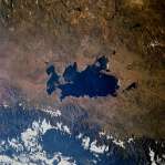 Photo #: STS057-75-46 Photo #: STS057-75-46Description: LAKE TITICACA-1993--DETAILED VIEW; LAKE LEVEL CHANGE Sequence ID: 5C Photo #: STS057-99-65 ** Currently displayed photo ** Description: PERU/BOLIVIA-1993; L. TITICACA, L. POOPO REGION-SYNOPTIC VIEW Sequence ID: 6A  Photo #: SL3-115-1911 Photo #: SL3-115-1911Description: BOLIVIA, LAKE POOPO-1973; LAKE LEVEL Sequence ID: 6B  Photo #: STS51J-144-23 Photo #: STS51J-144-23Description: BOLIVIA, LAKE POOPO-1985; LAKE LEVEL Sequence ID: 6C 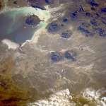 Photo #: STS026-40-64 Photo #: STS026-40-64Description: BOLIVIA, LAKE POOPO, LAKE COIPASA-1988; LAKE POOPO LAKE LEVEL Sequence ID: 6D  Photo #: STS032-88-69 Photo #: STS032-88-69Description: BOLIVIA, LAKE POOPO-1990; LAKE LEVEL Sequence ID: 6E  Photo #: STS048-72-49 Photo #: STS048-72-49Description: BOLIVIA, LAKE POOPO-1991; LAKE LEVEL CHANGES Sequence ID: 6F  Photo #: STS064-91-22 Photo #: STS064-91-22Description: BOLIVIA, LAKE POOPO-1994; DECREASING LAKE LEVEL Sequence ID: 6G 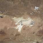 Photo #: STS073-735-47 Photo #: STS073-735-47Description: BOLIVIA, LAKE POOPO-1995; LAKE IS DRY Sequence ID: 6H | ||
| NASA Home Page |
JSC Home Page |
JSC Digital Image Collection |
Earth Science & Remote Sensing |
|
This service is provided by the International Space Station program and the JSC Earth Science & Remote Sensing Unit, ARES Division, Exploration Integration Science Directorate.

|