
Geographic Region: MEXICO
Feature: AGR.,FALCON RES.,MTS.
|
Geographic Region: MEXICO Feature: AGR.,FALCON RES.,MTS. |
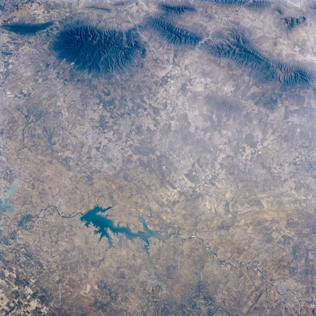 |
| STS056-077-057 Falcon Reservoir, Texas, U.S.A. April 1993 Falcon Reservoir, a dammed lake on the Rio Grande operated jointly by Mexico and the United States, is used for irrigation, electric power, and recreation. Barely discernible are Laredo and its Mexican counterpart, Nuevo Laredo (lower right corner). Because it receives less than 20 inches (8 centimeters) of rainfall annually, this semiarid area is identified as the Arid Plains. Visible (top of photograph) are the darker outliers of the more massive Sierra Madre Oriental range of northeast Mexico. |
| Images: | All Available Images Low-Resolution 370k |
|
| Mission: | STS056 |
|
| Roll - Frame: | 77 - 57 |
|
| Geographical Name: | MEXICO |
|
| Features: | AGR.,FALCON RES.,MTS. |
|
| Center Lat x Lon: | 26.5N x 99.5W |
|
| Film Exposure: | N | N=Normal exposure, U=Under exposed, O=Over exposed, F=out of Focus |
| Percentage of Cloud Cover-CLDP: | 0 |
|
| Camera:: | HB |
|
| Camera Tilt: | 13 | LO=Low Oblique, HO=High Oblique, NV=Near Vertical |
| Camera Focal Length: | 100 |
|
| Nadir to Photo Center Direction: | S | The direction from the nadir to the center point, N=North, S=South, E=East, W=West |
| Stereo?: | Y | Y=Yes there is an adjacent picture of the same area, N=No there isn't |
| Orbit Number: | 39 |
|
| Date: | 19930410 | YYYYMMDD |
| Time: | 151701 | GMT HHMMSS |
| Nadir Lat: | 27.1N |
Latitude of suborbital point of spacecraft |
| Nadir Lon: | 99.6W |
Longitude of suborbital point of spacecraft |
| Sun Azimuth: | 102 | Clockwise angle in degrees from north to the sun measured at the nadir point |
| Space Craft Altitude: | 161 | nautical miles |
| Sun Elevation: | 38 | Angle in degrees between the horizon and the sun, measured at the nadir point |
| Land Views: | RANGE, MOUNTAIN |
|
| Water Views: | RESERVOIR, RIVER |
|
| Atmosphere Views: | |
|
| Man Made Views: | |
|
| City Views: | |
|
Photo is not associated with any sequences | ||
| NASA Home Page |
JSC Home Page |
JSC Digital Image Collection |
Earth Science & Remote Sensing |
|
This service is provided by the International Space Station program and the JSC Earth Science & Remote Sensing Unit, ARES Division, Exploration Integration Science Directorate.

|