
Geographic Region: USA-TEXAS
Feature: BIG SPRING,MIDLAND
|
Geographic Region: USA-TEXAS Feature: BIG SPRING,MIDLAND |
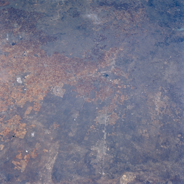 |
| STS056-077-045 High Plains, Texas, U.S.A. April 1993 Barely discernible are the faint outlines of Odessa and Midland along Interstate Highway 20 in this northeast-looking photograph of the high plains of west Texas. Most of the urban development for these cities has occurred on the north side of the interstate highway. Visible 30 miles (48 kilometers) east of Midland is small, dark Natural Dam Salt Lake, and to its east is northwest-southeast-oriented U.S. Highway 87 that connects Big Spring and Lamesa. The dark landscape denotes extensive areas of scrubby, desert vegetation, which provide scarce grazing for cattle in these relatively flat, slightly elevated plains. Numerous oil and gas fields are scattered throughout this region, many of which can be identified by a concentration of uniformly spaced white dots. Visible is the eastern edge of Monahans Sandhills State Park (bottom of photograph). |
| Images: | All Available Images Low-Resolution 337k |
|
| Mission: | STS056 |
|
| Roll - Frame: | 77 - 45 |
|
| Geographical Name: | USA-TEXAS |
|
| Features: | BIG SPRING,MIDLAND |
|
| Center Lat x Lon: | 32.5N x 101.5W |
|
| Film Exposure: | N | N=Normal exposure, U=Under exposed, O=Over exposed, F=out of Focus |
| Percentage of Cloud Cover-CLDP: | 5 |
|
| Camera:: | HB |
|
| Camera Tilt: | 39 | LO=Low Oblique, HO=High Oblique, NV=Near Vertical |
| Camera Focal Length: | 100 |
|
| Nadir to Photo Center Direction: | E | The direction from the nadir to the center point, N=North, S=South, E=East, W=West |
| Stereo?: | Y | Y=Yes there is an adjacent picture of the same area, N=No there isn't |
| Orbit Number: | 39 |
|
| Date: | 19930410 | YYYYMMDD |
| Time: | 151532 | GMT HHMMSS |
| Nadir Lat: | 31.7N |
Latitude of suborbital point of spacecraft |
| Nadir Lon: | 103.5W |
Longitude of suborbital point of spacecraft |
| Sun Azimuth: | 102 | Clockwise angle in degrees from north to the sun measured at the nadir point |
| Space Craft Altitude: | 162 | nautical miles |
| Sun Elevation: | 34 | Angle in degrees between the horizon and the sun, measured at the nadir point |
| Land Views: | PLAIN, DUNE |
|
| Water Views: | LAKE |
|
| Atmosphere Views: | |
|
| Man Made Views: | HIGHWAY, DRILLING, URBAN AREA, AGRICULTURE |
|
| City Views: | |
|
Photo is not associated with any sequences | ||
| NASA Home Page |
JSC Home Page |
JSC Digital Image Collection |
Earth Science & Remote Sensing |
|
This service is provided by the International Space Station program and the JSC Earth Science & Remote Sensing Unit, ARES Division, Exploration Integration Science Directorate.

|