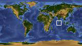
Geographic Region: MALDIVES
Feature: NILANDU ATOLL AREA
|
Geographic Region: MALDIVES Feature: NILANDU ATOLL AREA |
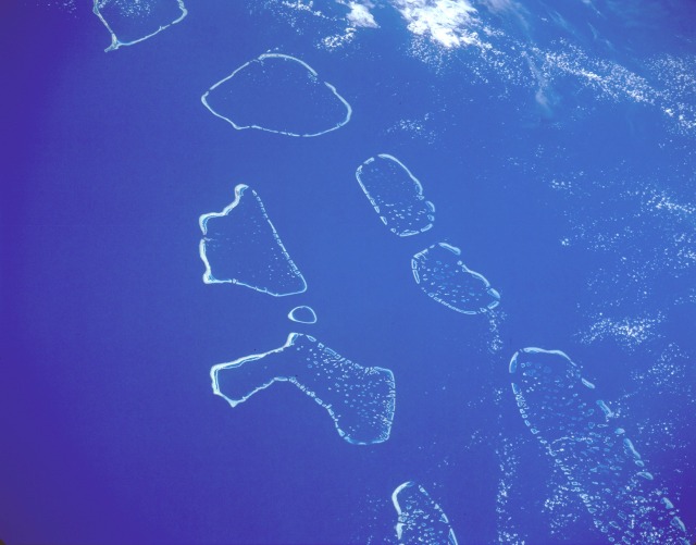 |
| STS056-152-160 Maldives April 1993 This south-looking, low-oblique photograph shows (from north to south) the Ari, Male, Felidu, Nilande, Mulaku, and Kolumadulu Atolls of the Maldives. The 19 atolls of the Maldives are composed of more than 2000 small coral formations in the Indian Ocean southwest of India and Sri Lanka. The chain extends north-south for approximately 550 miles (880 kilometers). The Maldives are the exposed top of a long, narrow submarine ridge whose average height is 4 to 6 feet (1 to 2 meters) above sea level. Most of the atolls have spacious, deep-water lagoons suitable for ship anchorage, and some have freshwater lagoons. The Maldives have a tropical monsoonal climate, with most of the rainfall occurring from June to December. Most of the islands have poor soil and are covered by dense scrub with scattered trees, including coconut palms. Fishing and tourism are the two major industries of the country. A densely populated country, with more than 150 000 people in its total land area of 115 square miles (298 square kilometers), this island country is one of the 25 least-developed countries in the world, according to a United Nations report. |
| Images: | All Available Images Low-Resolution 68k |
|
| Mission: | STS056 |
|
| Roll - Frame: | 152 - 160 |
|
| Geographical Name: | MALDIVES |
|
| Features: | NILANDU ATOLL AREA |
|
| Center Lat x Lon: | 3.0N x 73.0E |
|
| Film Exposure: | N | N=Normal exposure, U=Under exposed, O=Over exposed, F=out of Focus |
| Percentage of Cloud Cover-CLDP: | 20 |
|
| Camera:: | LH |
|
| Camera Tilt: | 49 | LO=Low Oblique, HO=High Oblique, NV=Near Vertical |
| Camera Focal Length: | 250 |
|
| Nadir to Photo Center Direction: | SW | The direction from the nadir to the center point, N=North, S=South, E=East, W=West |
| Stereo?: | Y | Y=Yes there is an adjacent picture of the same area, N=No there isn't |
| Orbit Number: | 32 |
|
| Date: | 19930410 | YYYYMMDD |
| Time: | 045052 | GMT HHMMSS |
| Nadir Lat: | 5.4N |
Latitude of suborbital point of spacecraft |
| Nadir Lon: | 75.0E |
Longitude of suborbital point of spacecraft |
| Sun Azimuth: | 84 | Clockwise angle in degrees from north to the sun measured at the nadir point |
| Space Craft Altitude: | 160 | nautical miles |
| Sun Elevation: | 58 | Angle in degrees between the horizon and the sun, measured at the nadir point |
| Land Views: | ATOLL |
|
| Water Views: | OCEAN, LAGOON, REEF |
|
| Atmosphere Views: | |
|
| Man Made Views: | |
|
| City Views: | |
|
Photo is not associated with any sequences | ||
| NASA Home Page |
JSC Home Page |
JSC Digital Image Collection |
Earth Science & Remote Sensing |
|
This service is provided by the International Space Station program and the JSC Earth Science & Remote Sensing Unit, ARES Division, Exploration Integration Science Directorate.

|