
Geographic Region: USA-NEW MEXICO
Feature: LOVINGTON, HOBBS
|
Geographic Region: USA-NEW MEXICO Feature: LOVINGTON, HOBBS |
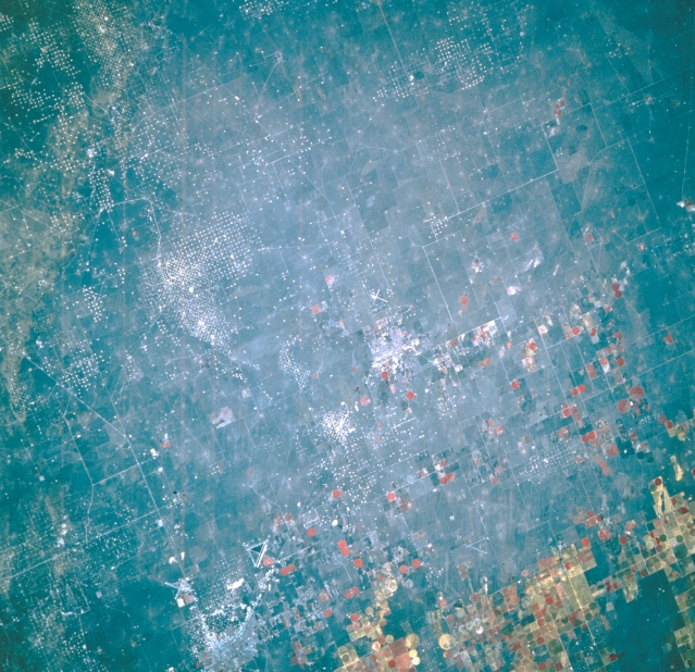 |
| STS056-109-024 Hobbs, New Mexico, U.S.A. April 1993 Visible are scattered white dots that designate producing oil and gas wells west and northwest of Hobbs whose faint outline appears along the bottom left side of the photograph. Apparent are two airports and their respective intersecting runways west and northwest of Hobbs; State Highway 18, which connects Hobbs with Lovington to the northwest, another small community near the Texas-New Mexico border; and rectangular and circular irrigated, cultivated fields, most of which are located in west Texas. |
| Images: | All Available Images Low-Resolution 383k |
|
| Mission: | STS056 |
|
| Roll - Frame: | 109 - 24 |
|
| Geographical Name: | USA-NEW MEXICO |
|
| Features: | LOVINGTON, HOBBS |
|
| Center Lat x Lon: | 33.0N x 103.5W |
|
| Film Exposure: | N | N=Normal exposure, U=Under exposed, O=Over exposed, F=out of Focus |
| Percentage of Cloud Cover-CLDP: | 0 |
|
| Camera:: | HB |
|
| Camera Tilt: | 18 | LO=Low Oblique, HO=High Oblique, NV=Near Vertical |
| Camera Focal Length: | 250 |
|
| Nadir to Photo Center Direction: | NE | The direction from the nadir to the center point, N=North, S=South, E=East, W=West |
| Stereo?: | N | Y=Yes there is an adjacent picture of the same area, N=No there isn't |
| Orbit Number: | 39 |
|
| Date: | 19930410 | YYYYMMDD |
| Time: | 151519 | GMT HHMMSS |
| Nadir Lat: | 32.3N |
Latitude of suborbital point of spacecraft |
| Nadir Lon: | 104W |
Longitude of suborbital point of spacecraft |
| Sun Azimuth: | 102 | Clockwise angle in degrees from north to the sun measured at the nadir point |
| Space Craft Altitude: | 162 | nautical miles |
| Sun Elevation: | 33 | Angle in degrees between the horizon and the sun, measured at the nadir point |
| Land Views: | PLAIN |
|
| Water Views: | |
|
| Atmosphere Views: | |
|
| Man Made Views: | DRILLING, PIVOT IRRIGATION, AIRPORT, HIGHWAY |
|
| City Views: | |
|
Photo is not associated with any sequences | ||
| NASA Home Page |
JSC Home Page |
JSC Digital Image Collection |
Earth Science & Remote Sensing |
|
This service is provided by the International Space Station program and the JSC Earth Science & Remote Sensing Unit, ARES Division, Exploration Integration Science Directorate.

|