
Geographic Region: IRAN
Feature: KHARG ISLAND, TANKERS
|
Geographic Region: IRAN Feature: KHARG ISLAND, TANKERS |
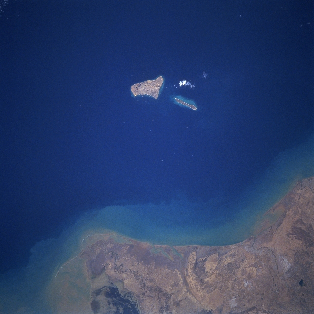 |
| STS055-092-084 Kharg Island, Iran April 1993 Kharg Island, as seen in this near-nadir view, is located in the northeastern Persian Gulf, 16 miles (25 km) off the coast of Iran and 300 miles (483 km) north of the Strait of Hormuz. Once the world's largest offshore crude oil terminal and the principal sea terminal for Iranian oil, the Kharg Island facilities were put out of commission in the fall of 1986. Heavy bombing of the Kharg Island facilities from 1982 through 1986 by the air forces of the government of Iraq during the Iran-Iraq War all but destroyed most of the terminal facilities. Kharg Island was situated in the middle of the Darius Oilfield, also destroyed by the intensive bombing. Repair to all facilities has been very slow, even after the war ended in 1988, due to continued hostile intentions by the Iraqi Government and the Gulf War or 1990-1991. |
| Images: | All Available Images Low-Resolution 275k |
|
| Mission: | STS055 |
|
| Roll - Frame: | 92 - 84 |
|
| Geographical Name: | IRAN |
|
| Features: | KHARG ISLAND, TANKERS |
|
| Center Lat x Lon: | 29.5N x 50.5E |
|
| Film Exposure: | N | N=Normal exposure, U=Under exposed, O=Over exposed, F=out of Focus |
| Percentage of Cloud Cover-CLDP: | 5 |
|
| Camera:: | HB |
|
| Camera Tilt: | 21 | LO=Low Oblique, HO=High Oblique, NV=Near Vertical |
| Camera Focal Length: | 250 |
|
| Nadir to Photo Center Direction: | N | The direction from the nadir to the center point, N=North, S=South, E=East, W=West |
| Stereo?: | Y | Y=Yes there is an adjacent picture of the same area, N=No there isn't |
| Orbit Number: | 11 |
|
| Date: | 19930427 | YYYYMMDD |
| Time: | 055901 | GMT HHMMSS |
| Nadir Lat: | 28.5N |
Latitude of suborbital point of spacecraft |
| Nadir Lon: | 50.8E |
Longitude of suborbital point of spacecraft |
| Sun Azimuth: | 104 | Clockwise angle in degrees from north to the sun measured at the nadir point |
| Space Craft Altitude: | 163 | nautical miles |
| Sun Elevation: | 51 | Angle in degrees between the horizon and the sun, measured at the nadir point |
| Land Views: | ISLAND |
|
| Water Views: | GULF |
|
| Atmosphere Views: | |
|
| Man Made Views: | PORT |
|
| City Views: | |
|
Photo is not associated with any sequences | ||
| NASA Home Page |
JSC Home Page |
JSC Digital Image Collection |
Earth Science & Remote Sensing |
|
This service is provided by the International Space Station program and the JSC Earth Science & Remote Sensing Unit, ARES Division, Exploration Integration Science Directorate.

|