
Geographic Region: USA-TEXAS
Feature: PEARSALL AREA,HIGHWAY
|
Geographic Region: USA-TEXAS Feature: PEARSALL AREA,HIGHWAY |
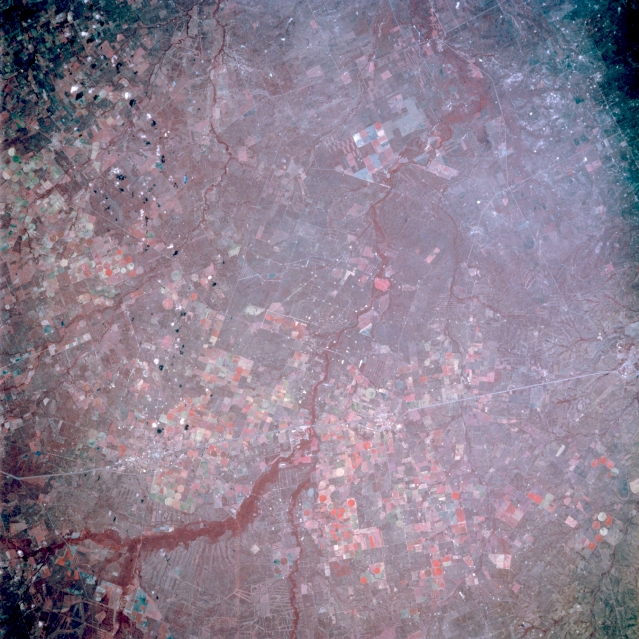 |
| STS050-088-062 Pearsall, Texas, U.S.A. July 1992 The Frio River is visible as it meanders south and southeast and intersects with Interstate Highway 35. Approximately 12 miles (19 kilometers) north of the highway-river junction is Pearsall, southeast of which is the Pearsall oil field (barely discernible). The smaller town of Dilley lies approximately 5 miles (8 kilometers) south on Interstate Highway 35. Circular field patterns indicate that irrigation is required to provide sufficient moisture for crop production in this part of south-central Texas. |
| Images: | All Available Images Low-Resolution 366k |
|
| Mission: | STS050 |
|
| Roll - Frame: | 88 - 62 |
|
| Geographical Name: | USA-TEXAS |
|
| Features: | PEARSALL AREA,HIGHWAY |
|
| Center Lat x Lon: | 29.0N x 99W |
|
| Film Exposure: | N | N=Normal exposure, U=Under exposed, O=Over exposed, F=out of Focus |
| Percentage of Cloud Cover-CLDP: | 0 |
|
| Camera:: | HB |
|
| Camera Tilt: | 24 | LO=Low Oblique, HO=High Oblique, NV=Near Vertical |
| Camera Focal Length: | 250 |
|
| Nadir to Photo Center Direction: | NE | The direction from the nadir to the center point, N=North, S=South, E=East, W=West |
| Stereo?: | N | Y=Yes there is an adjacent picture of the same area, N=No there isn't |
| Orbit Number: | 49 |
|
| Date: | 19920628 | YYYYMMDD |
| Time: | 163736 | GMT HHMMSS |
| Nadir Lat: | 28.2N |
Latitude of suborbital point of spacecraft |
| Nadir Lon: | 99.9W |
Longitude of suborbital point of spacecraft |
| Sun Azimuth: | 92 | Clockwise angle in degrees from north to the sun measured at the nadir point |
| Space Craft Altitude: | 162 | nautical miles |
| Sun Elevation: | 61 | Angle in degrees between the horizon and the sun, measured at the nadir point |
| Land Views: | RANGE |
|
| Water Views: | RIVER |
|
| Atmosphere Views: | |
|
| Man Made Views: | HIGHWAY, AGRICULTURE, DRILLING |
|
| City Views: | |
|
Photo is not associated with any sequences | ||
| NASA Home Page |
JSC Home Page |
JSC Digital Image Collection |
Earth Science & Remote Sensing |
|
This service is provided by the International Space Station program and the JSC Earth Science & Remote Sensing Unit, ARES Division, Exploration Integration Science Directorate.

|