
Geographic Region: USA-WYOMING
Feature: BIG HORN MTS.
|
Geographic Region: USA-WYOMING Feature: BIG HORN MTS. |
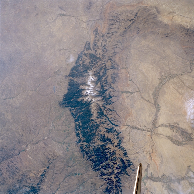 |
| STS047-097-028 Bighorn Mountains, Wyoming, U.S.A. September 1992 Visible in this south-southeast-looking, low-oblique photograph are the forested Bighorn Mountains, which began to form approximately 60 million years ago and extend almost 120 miles (195 kilometers) southeast from the Montana-Wyoming border into central Wyoming. Cloud Peak, the highest point in the glacier-carved range at 13 175 feet (4018 meters), consists mostly of Precambrian basement rocks. East of the mountain range is the western portion of the Power River Basin; to the west is the eastern portion of the Bighorn Basin with its irrigated farmland along the Bighorn, Shoshone, and Greybull Rivers. |
| Images: | All Available Images Low-Resolution 344k |
|
| Mission: | STS047 |
|
| Roll - Frame: | 97 - 28 |
|
| Geographical Name: | USA-WYOMING |
|
| Features: | BIG HORN MTS. |
|
| Center Lat x Lon: | 44.5N x 107W |
|
| Film Exposure: | N | N=Normal exposure, U=Under exposed, O=Over exposed, F=out of Focus |
| Percentage of Cloud Cover-CLDP: | 5 |
|
| Camera:: | HB |
|
| Camera Tilt: | 30 | LO=Low Oblique, HO=High Oblique, NV=Near Vertical |
| Camera Focal Length: | 100 |
|
| Nadir to Photo Center Direction: | SE | The direction from the nadir to the center point, N=North, S=South, E=East, W=West |
| Stereo?: | Y | Y=Yes there is an adjacent picture of the same area, N=No there isn't |
| Orbit Number: | 50 |
|
| Date: | 19920915 | YYYYMMDD |
| Time: | 163143 | GMT HHMMSS |
| Nadir Lat: | 45.5N |
Latitude of suborbital point of spacecraft |
| Nadir Lon: | 108.3W |
Longitude of suborbital point of spacecraft |
| Sun Azimuth: | 129 | Clockwise angle in degrees from north to the sun measured at the nadir point |
| Space Craft Altitude: | 169 | nautical miles |
| Sun Elevation: | 35 | Angle in degrees between the horizon and the sun, measured at the nadir point |
| Land Views: | MOUNTAIN, FOREST, BASIN |
|
| Water Views: | |
|
| Atmosphere Views: | |
|
| Man Made Views: | |
|
| City Views: | |
|
Photo is not associated with any sequences | ||
| NASA Home Page |
JSC Home Page |
JSC Digital Image Collection |
Earth Science & Remote Sensing |
|
This service is provided by the International Space Station program and the JSC Earth Science & Remote Sensing Unit, ARES Division, Exploration Integration Science Directorate.

|