
Geographic Region: ISRAEL
Feature: HAIFA, LAKE TIBERIAS
|
Geographic Region: ISRAEL Feature: HAIFA, LAKE TIBERIAS |
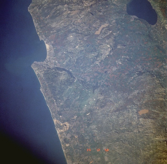 |
| STS045-601-023 Haifa, Israel March 1992 The seaport of Haifa (population of approximately 290 000) is located at the south end of Haifa Bay in northern Israel. Except for a few airport runways, no infrastructure can be discerned at this scale. A narrow coastal plain abuts this segment of the eastern Mediterranean Sea. The Sea of Galilee (Lake Tiberias), the large body of water approximately 25 miles (40 kilometers) inland from Haifa, is reported to be a freshwater lake, although some publications report saline characteristics. Most water recharge entering the Sea of Galilee comes from melting snow off the mountains at the northern end of the Jordan River. The topography is rugged and hilly with the exception of sizable cultivated plains (green and brown field patterns) west-southwest of the Sea of Galilee. |
| Images: | All Available Images Low-Resolution 120k |
|
| Mission: | STS045 |
|
| Roll - Frame: | 601 - 23 |
|
| Geographical Name: | ISRAEL |
|
| Features: | HAIFA, LAKE TIBERIAS |
|
| Center Lat x Lon: | 32.5N x 35.5E |
|
| Film Exposure: | N | N=Normal exposure, U=Under exposed, O=Over exposed, F=out of Focus |
| Percentage of Cloud Cover-CLDP: | 0 |
|
| Camera:: | RX |
|
| Camera Tilt: | 45 | LO=Low Oblique, HO=High Oblique, NV=Near Vertical |
| Camera Focal Length: | 250 |
|
| Nadir to Photo Center Direction: | E | The direction from the nadir to the center point, N=North, S=South, E=East, W=West |
| Stereo?: | N | Y=Yes there is an adjacent picture of the same area, N=No there isn't |
| Orbit Number: | 33 |
|
| Date: | 19920326 | YYYYMMDD |
| Time: | 135800 | GMT HHMMSS |
| Nadir Lat: | 32.8N |
Latitude of suborbital point of spacecraft |
| Nadir Lon: | 32.8E |
Longitude of suborbital point of spacecraft |
| Sun Azimuth: | 255 | Clockwise angle in degrees from north to the sun measured at the nadir point |
| Space Craft Altitude: | 163 | nautical miles |
| Sun Elevation: | 25 | Angle in degrees between the horizon and the sun, measured at the nadir point |
| Land Views: | COAST, HILL, VALLEY |
|
| Water Views: | SEA, LAKE |
|
| Atmosphere Views: | |
|
| Man Made Views: | URBAN AREA, AGRICULTURE |
|
| City Views: | |
|
Photo is not associated with any sequences | ||
| NASA Home Page |
JSC Home Page |
JSC Digital Image Collection |
Earth Science & Remote Sensing |
|
This service is provided by the International Space Station program and the JSC Earth Science & Remote Sensing Unit, ARES Division, Exploration Integration Science Directorate.

|