
Geographic Region: COLOMBIA
Feature: SANTA MARTA MTNS, COAST
|
Geographic Region: COLOMBIA Feature: SANTA MARTA MTNS, COAST |
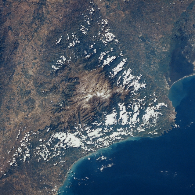 |
| STS032-071-039 Sierra Nevada de Santa Marta, Colombia January 1990 The highest coastal mountain range in the world, the Sierra Nevada de Santa Marta is visible in this east-southeast-looking view. The Sierra Nevada de Santa Marta includes several climatic zones across a strip only 25 miles (40 km) from the sea. These zones include a tropical climate at the coast to a perpetual snow line above 16,000 feet (4880 meters) and a cold Alpine climate. The two highest peaks in the Santa Marta Range are Cristobal Colon Peak (named after Christopher Colombus) 19029 feet (5800 meters) and Simon Bolivar Peak (named after the famous South American liberator) 18947 feet (5775 meters). Small glacier fields at the top of the range cover an area of 6 sq. miles (16 sq. km). The Sierra Nevada de Santa Marta serves as the source of 36 streams and rivers. To the west of the Santa Marta Range just to the right of the bottom center of the image, is a swamp-like feature, the Cienaga Grande. To the left of the Cienaga Grande swamps near the bottom center of the scene is the city of Santa Marta, the oldest city of European origin in South America. |
| Images: | All Available Images Low-Resolution 401k |
|
| Mission: | STS032 |
|
| Roll - Frame: | 71 - 39 |
|
| Geographical Name: | COLOMBIA |
|
| Features: | SANTA MARTA MTNS, COAST |
|
| Center Lat x Lon: | 11.0N x 73.5W |
|
| Film Exposure: | N | N=Normal exposure, U=Under exposed, O=Over exposed, F=out of Focus |
| Percentage of Cloud Cover-CLDP: | 25 |
|
| Camera:: | HB |
|
| Camera Tilt: | 6 | LO=Low Oblique, HO=High Oblique, NV=Near Vertical |
| Camera Focal Length: | 100 |
|
| Nadir to Photo Center Direction: | N | The direction from the nadir to the center point, N=North, S=South, E=East, W=West |
| Stereo?: | Y | Y=Yes there is an adjacent picture of the same area, N=No there isn't |
| Orbit Number: | 35 |
|
| Date: | 19900111 | YYYYMMDD |
| Time: | 163010 | GMT HHMMSS |
| Nadir Lat: | 10.7N |
Latitude of suborbital point of spacecraft |
| Nadir Lon: | 73.5W |
Longitude of suborbital point of spacecraft |
| Sun Azimuth: | 166 | Clockwise angle in degrees from north to the sun measured at the nadir point |
| Space Craft Altitude: | 175 | nautical miles |
| Sun Elevation: | 56 | Angle in degrees between the horizon and the sun, measured at the nadir point |
| Land Views: | MOUNTAIN, COAST, VALLEY |
|
| Water Views: | SEA, LAGOON |
|
| Atmosphere Views: | |
|
| Man Made Views: | |
|
| City Views: | |
|
Photo is not associated with any sequences | ||
| NASA Home Page |
JSC Home Page |
JSC Digital Image Collection |
Earth Science & Remote Sensing |
|
This service is provided by the International Space Station program and the JSC Earth Science & Remote Sensing Unit, ARES Division, Exploration Integration Science Directorate.

|