
Geographic Region: USA-IOWA
Feature: BURLINGTON,MISSISSIPPI R
|
Geographic Region: USA-IOWA Feature: BURLINGTON,MISSISSIPPI R |
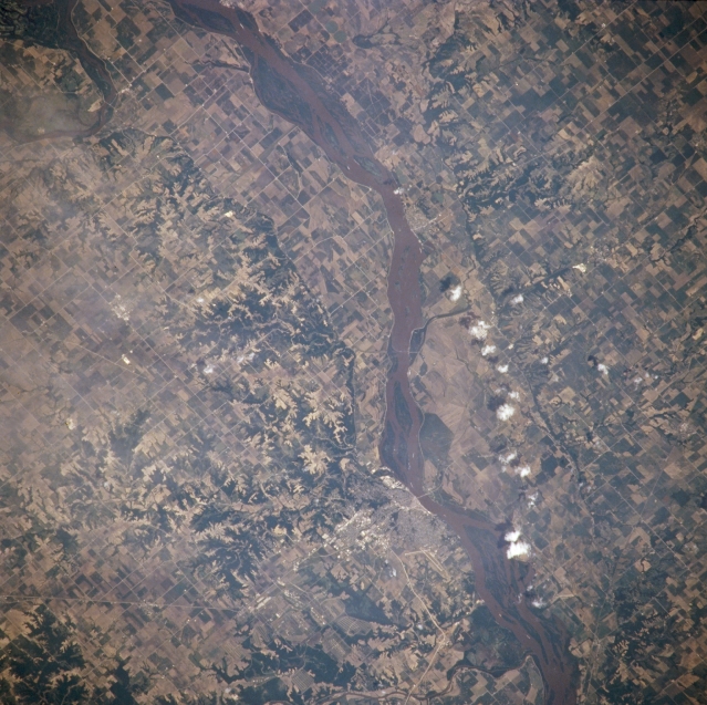 |
| NM21-765-036 Mississippi River and Burlington, Iowa, U.S.A. Winter 1995-1996 The muddy Mississippi River and numerous agricultural field patterns in its floodplain are featured in this northeast-looking, low-oblique photograph. Burlington, a river city (midway between center and bottom center) on the west bank of the Mississippi, is a farm, shipping, and manufacturing center in this rich agricultural region and home of one of the state's oldest newspapers still in publication. |
| Images: | All Available Images Low-Resolution 367k |
|
| Mission: | NM21 |
|
| Roll - Frame: | 765 - 36 |
|
| Geographical Name: | USA-IOWA |
|
| Features: | BURLINGTON,MISSISSIPPI R |
|
| Center Lat x Lon: | 41.0N x 91W |
|
| Film Exposure: | N | N=Normal exposure, U=Under exposed, O=Over exposed, F=out of Focus |
| Percentage of Cloud Cover-CLDP: | 5 |
|
| Camera:: | HB |
|
| Camera Tilt: | 14 | LO=Low Oblique, HO=High Oblique, NV=Near Vertical |
| Camera Focal Length: | 250 |
|
| Nadir to Photo Center Direction: | N | The direction from the nadir to the center point, N=North, S=South, E=East, W=West |
| Stereo?: | Y | Y=Yes there is an adjacent picture of the same area, N=No there isn't |
| Orbit Number: | 999 |
|
| Date: | 19960703 | YYYYMMDD |
| Time: | 165141 | GMT HHMMSS |
| Nadir Lat: | 40.2N |
Latitude of suborbital point of spacecraft |
| Nadir Lon: | 91.3W |
Longitude of suborbital point of spacecraft |
| Sun Azimuth: | 130 | Clockwise angle in degrees from north to the sun measured at the nadir point |
| Space Craft Altitude: | 208 | nautical miles |
| Sun Elevation: | 66 | Angle in degrees between the horizon and the sun, measured at the nadir point |
| Land Views: | |
|
| Water Views: | RIVER |
|
| Atmosphere Views: | |
|
| Man Made Views: | DAM, AGRICULTURE, URBAN AREA |
|
| City Views: | BURLINGTON |
|
Photo is not associated with any sequences | ||
| NASA Home Page |
JSC Home Page |
JSC Digital Image Collection |
Earth Science & Remote Sensing |
|
This service is provided by the International Space Station program and the JSC Earth Science & Remote Sensing Unit, ARES Division, Exploration Integration Science Directorate.

|