
Geographic Region: USA-IOWA
Feature: DES MOINES R.,FT. MADISON
|
Geographic Region: USA-IOWA Feature: DES MOINES R.,FT. MADISON |
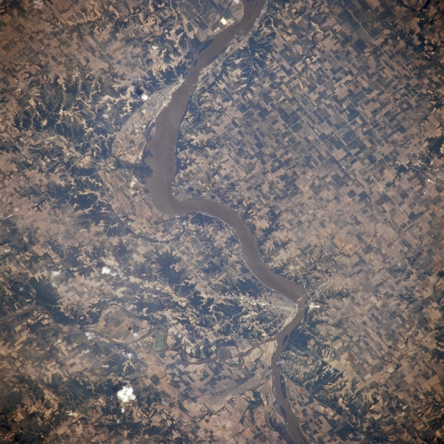 |
| NM21-765-034 Lake Keokuk, Keokuk, and Fort Madison, Iowa, U.S.A. Winter 1995-1996 Lake Keokuk, part of the muddy Mississippi River, is featured in this northeast-looking, low-oblique photograph. The lake and the 53-foot (16-meter) gravity dam, which was completed in 1913, provide hydroelectric power for Keokuk, located on the west bank of the Mississippi River (just below center). Immediately south of Keokuk, the Des Moines River joins the Mississippi River. North of Keokuk is Fort Madison, a river port and a rail, commercial, and industrial center in a rich agricultural area. The city, originally established in 1808 as a trading post, was the site of the first fort west of the Mississippi River. |
| Images: | All Available Images Low-Resolution 384k |
|
| Mission: | NM21 |
|
| Roll - Frame: | 765 - 34 |
|
| Geographical Name: | USA-IOWA |
|
| Features: | DES MOINES R.,FT. MADISON |
|
| Center Lat x Lon: | 40.5N x 91.5W |
|
| Film Exposure: | N | N=Normal exposure, U=Under exposed, O=Over exposed, F=out of Focus |
| Percentage of Cloud Cover-CLDP: | 0 |
|
| Camera:: | HB |
|
| Camera Tilt: | 9 | LO=Low Oblique, HO=High Oblique, NV=Near Vertical |
| Camera Focal Length: | 250 |
|
| Nadir to Photo Center Direction: | N | The direction from the nadir to the center point, N=North, S=South, E=East, W=West |
| Stereo?: | Y | Y=Yes there is an adjacent picture of the same area, N=No there isn't |
| Orbit Number: | 999 |
|
| Date: | 19960703 | YYYYMMDD |
| Time: | 165136 | GMT HHMMSS |
| Nadir Lat: | 40.0N |
Latitude of suborbital point of spacecraft |
| Nadir Lon: | 91.7W |
Longitude of suborbital point of spacecraft |
| Sun Azimuth: | 129 | Clockwise angle in degrees from north to the sun measured at the nadir point |
| Space Craft Altitude: | 208 | nautical miles |
| Sun Elevation: | 66 | Angle in degrees between the horizon and the sun, measured at the nadir point |
| Land Views: | |
|
| Water Views: | RIVER |
|
| Atmosphere Views: | |
|
| Man Made Views: | AGRICULTURE, DAM, URBAN AREA |
|
| City Views: | |
|
Photo is not associated with any sequences | ||
| NASA Home Page |
JSC Home Page |
JSC Digital Image Collection |
Earth Science & Remote Sensing |
|
This service is provided by the International Space Station program and the JSC Earth Science & Remote Sensing Unit, ARES Division, Exploration Integration Science Directorate.

|