
Geographic Region: USA-KANSAS
Feature: DODGE CITY, ARKANSAS R.
|
Geographic Region: USA-KANSAS Feature: DODGE CITY, ARKANSAS R. |
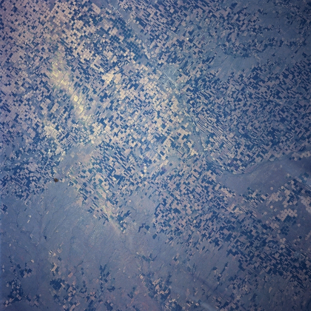 |
| NASA7-723-063 Dodge City Area, Kansas Spring, 1998 Located in the Great Plains of southwestern Kansas, Dodge City (an area of finer texture situated midway between the center and left center of the image) is discernible in this northeast-looking low-oblique view. Situated on the Arkansas River, Dodge City is a wheat and livestock distribution center. The city also produces agricultural implements and supplies in this mostly agriculture-based region. Dodge City was laid out as a railroad livestock shipping railhead in 1872 for the Santa Fe Railroad. The city flourished and become a wild and rowdy cow town. Some of its most famous residents were Wyatt Earp and Bat Masterson. Dodge City, as seen on the image, is surrounded by agricultural fields, including many circular central pivot-irrigation fields. Different colors in the fields represent different crops and different stages of planting. The Ogalala Acquifer supplies most of the underground water used to irrigate crops in the Dodge City area. |
| Images: | All Available Images Low-Resolution 416k |
|
| Mission: | NASA7 |
|
| Roll - Frame: | 723 - 63 |
|
| Geographical Name: | USA-KANSAS |
|
| Features: | DODGE CITY, ARKANSAS R. |
|
| Center Lat x Lon: | 37.5N x 100W |
|
| Film Exposure: | N | N=Normal exposure, U=Under exposed, O=Over exposed, F=out of Focus |
| Percentage of Cloud Cover-CLDP: | 0 |
|
| Camera:: | HB |
|
| Camera Tilt: | LO | LO=Low Oblique, HO=High Oblique, NV=Near Vertical |
| Camera Focal Length: | 250 |
|
| Nadir to Photo Center Direction: | The direction from the nadir to the center point, N=North, S=South, E=East, W=West |
|
| Stereo?: | Y | Y=Yes there is an adjacent picture of the same area, N=No there isn't |
| Orbit Number: | |
|
| Date: | 19980512 | YYYYMMDD |
| Time: | GMT HHMMSS |
|
| Nadir Lat: | N |
Latitude of suborbital point of spacecraft |
| Nadir Lon: | E |
Longitude of suborbital point of spacecraft |
| Sun Azimuth: | Clockwise angle in degrees from north to the sun measured at the nadir point |
|
| Space Craft Altitude: | nautical miles |
|
| Sun Elevation: | Angle in degrees between the horizon and the sun, measured at the nadir point |
|
| Land Views: | PLAIN |
|
| Water Views: | RIVER |
|
| Atmosphere Views: | |
|
| Man Made Views: | AGRICULTURE, PIVOT IRRIGATION |
|
| City Views: | |
|
Photo is not associated with any sequences | ||
| NASA Home Page |
JSC Home Page |
JSC Digital Image Collection |
Earth Science & Remote Sensing |
|
This service is provided by the International Space Station program and the JSC Earth Science & Remote Sensing Unit, ARES Division, Exploration Integration Science Directorate.

|