
Geographic Region: AUSTRALIA-SA
Feature: ADELAIDE,GULF ST. VINCENT
|
Geographic Region: AUSTRALIA-SA Feature: ADELAIDE,GULF ST. VINCENT |
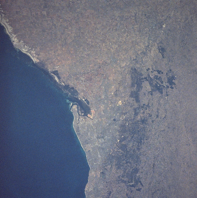 |
| NASA7-709-078 Adelaide Area, South Australia, Australia Winter/Spring 1998 Australia's fifth largest city, Adelaide, is visible slightly below the center of the image. Adelaide is the capital of South Australia and has a metropolitan population that exceeds one million people. The Port of Adelaide, located northwest of the capital, has a sheltered harbor that has been created by the large sand spit that juts northward along the eastern shoreline of the Gulf of St. Vincent. A hilly region, known as the Adelaide Hills, and low Mount Lofty Ranges (darker northeast-southwest aligned corridor) border the eastern edge of Adelaide. The hilly region northeast of Adelaide is noted for the vineyards that produce excellent wines. An extensive landscape of flat, fertile plains are located north of the urban area. Cultivated fields are identified as a network of angular-looking patterns. Linear-looking sandy beaches (lighter colored terrain) are visible along the coastline north of Adelaide. |
| Images: | All Available Images Low-Resolution 376k |
|
| Mission: | NASA7 |
|
| Roll - Frame: | 709 - 78 |
|
| Geographical Name: | AUSTRALIA-SA |
|
| Features: | ADELAIDE,GULF ST. VINCENT |
|
| Center Lat x Lon: | 35S x 138.5E |
|
| Film Exposure: | N | N=Normal exposure, U=Under exposed, O=Over exposed, F=out of Focus |
| Percentage of Cloud Cover-CLDP: | 0 |
|
| Camera:: | HB |
|
| Camera Tilt: | LO | LO=Low Oblique, HO=High Oblique, NV=Near Vertical |
| Camera Focal Length: | 250 |
|
| Nadir to Photo Center Direction: | The direction from the nadir to the center point, N=North, S=South, E=East, W=West |
|
| Stereo?: | Y | Y=Yes there is an adjacent picture of the same area, N=No there isn't |
| Orbit Number: | |
|
| Date: | 19980309 | YYYYMMDD |
| Time: | GMT HHMMSS |
|
| Nadir Lat: | N |
Latitude of suborbital point of spacecraft |
| Nadir Lon: | E |
Longitude of suborbital point of spacecraft |
| Sun Azimuth: | Clockwise angle in degrees from north to the sun measured at the nadir point |
|
| Space Craft Altitude: | nautical miles |
|
| Sun Elevation: | Angle in degrees between the horizon and the sun, measured at the nadir point |
|
| Land Views: | MOUNTAIN, PLAIN |
|
| Water Views: | GULF |
|
| Atmosphere Views: | |
|
| Man Made Views: | URBAN AREA, AGRICULTURE |
|
| City Views: | ADELAIDE |
|
Photo is not associated with any sequences | ||
| NASA Home Page |
JSC Home Page |
JSC Digital Image Collection |
Earth Science & Remote Sensing |
|
This service is provided by the International Space Station program and the JSC Earth Science & Remote Sensing Unit, ARES Division, Exploration Integration Science Directorate.

|